
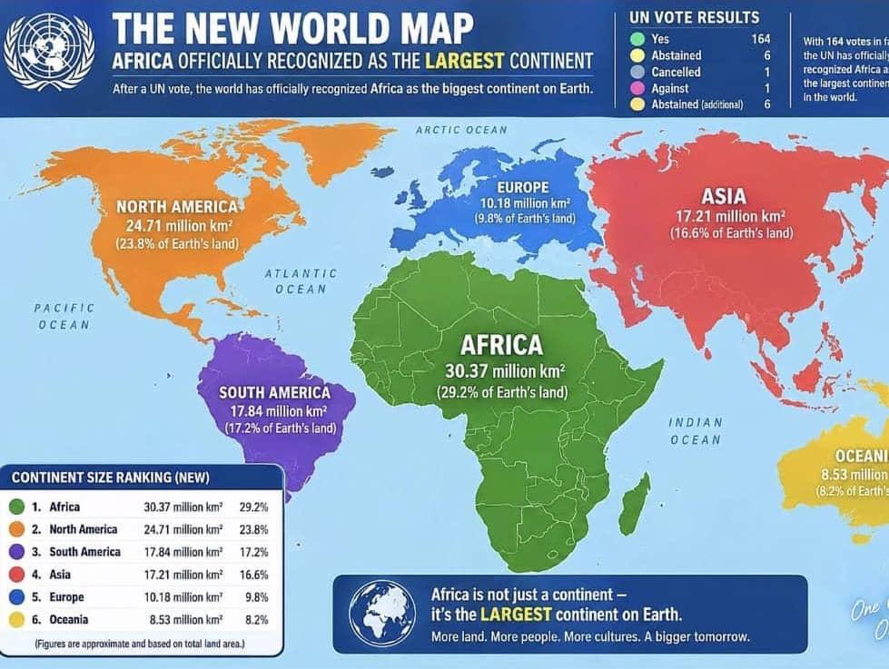
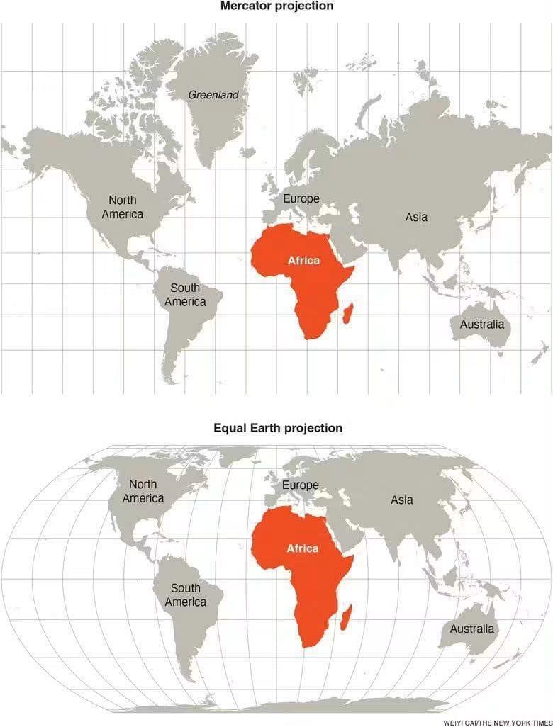
The United Nations General Assembly has voted to support the replacement of the traditional Mercator world map with a map that more accurately represents the actual size of continents, particularly Africa.
The resolution, known as “Correct the Map,” was sponsored by Togo and supported by members of the African Union. It received the backing of 164 countries, including France and the United Kingdom, while the United States voted against it and six countries abstained.
Although the resolution is non-binding, it is expected to encourage institutions around the world to adopt maps that provide a more accurate representation of the relative sizes of continents.
The Mercator projection, developed in 1569 by Flemish cartographer Gerardus Mercator, has been widely used for centuries, particularly for navigation. However, it has faced criticism because its projection significantly distorts the size of regions near the poles. Under the Mercator map, Africa can appear comparable in size to Greenland, despite Africa being about 14 times larger.
Read Also: UN Assembly Backs More Accurate Map Showing Africa’s True Size
The development has renewed discussions about how the world is visually represented on maps.
The early cartographers achieved remarkable results with the limited technology available to them, without satellites or modern mapping equipment.
The latest developments in mapping, however, are largely a result of technological advancement and improved geographical data, providing more accurate representations of the world. There is therefore no reason to view the development negatively; rather, it reflects the progress made in science and technology.






1 Comment